
Lava west
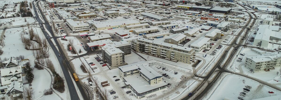
Hraun Vestur is a plot bordered by Fjarðarhraun, Hjallahraun and Reykjavíkurvegur. The area is well-located in terms of walking distances within Hafnarfjörður, as well as its transport links within the town and the greater Reykjavík area. All amenities are within easy reach, and Hafnarfjörður town centre is within walking distance.
The site's land use, according to the current master plan, is residential development, retail and service areas, and community service areas, but for the vast majority, it is a business area. The activities in the area are diverse and thriving, but the layout of the Hraun Vestur area is in many ways a product of its time. Furthermore, ideas about the mix of uses have changed over the years, and industry has largely given way to retail, services, residential development and other activities. In recent years, the area has developed to bear more of the characteristics of a town centre, with restaurants, shops, offices and related services, but a holistic vision for the area as a whole has been lacking.
Quality living environments and a diverse range of employment opportunities
Great potential lies in the future development of the area. The aim is to give the area a new identity, and the first step in this process is an amendment to the 2013-2025 Master Plan for Hafnarfjörður, so that a new land use, a so-called Central Area, is defined for the site, which provides for mixed-use development. By changing the land use to a central area, it will be permitted to have a mix of residential and commercial activities, and it is also envisaged that the development of the plots will allow for the existing activities to continue.
Hraun Vestur will offer flats in a relatively central, urban environment with good access to a wide range of services and public transport. Emphasis is placed on ensuring the area has well-accessible play and green spaces.
The Hraun Vestur development plan as a guide
The amendment to the master plan is intertwined with the development plan for Hraun West, which was approved by the Hafnarfjörður Town Council on 05.06.2024. The development plan is not a binding planning document, but rather strong guidelines, an overall vision, and a key policy and guiding principle for future development on a large-scale area. The aim is to provide opportunities for development and mixed-use, and to allow the neighbourhood to gradually transform into a dense, mixed-use settlement.
The development plan is based on the existing built-up area, ensuring that existing structures can remain and be adapted in line with the pattern of development and its use. Development in the area will proceed in phases and will take a long time.
Zoning plans
Following the main plan amendment or concurrently with its promotion, detailed plan amendments will be prepared for the plots of those parties who so wish, in cooperation with the Department of Environment and Planning. A detailed plan will be drawn up which will provide a more detailed description of the development with regard to density, building form, the interplay of open spaces and environmental quality, as well as phasing and the setting of conditions. The development plan is a tool used in the preparation of detailed plans for landowners and planning authorities when it comes to the detailed planning of individual sites. A detailed plan for the Gjótur district, with 490 dwellings, was approved in 2021. Proposals for detailed plans for other districts are in preparation.
The zoning plan can be accessed on the town's map website. – select a zoning plan from the drop-down menu on the right and find the area
The neighbourhoods in the neighbourhood
In the development plan, the area is divided into seven neighbourhoods, all of which have some characteristic feature: Goats, Plains, Hills, Slabs, Storks, Valley and Sticks. Each neighbourhood is developed from this unique feature, and residential development blends with it in different ways. A green area stretches from south to north, connecting the different neighbourhoods.