
Austurgatan with a historical sign and historical walk in Wappin
The health town of Hafnarfjörður and Wapp – Walking App have partnered to publish walking routes in Hafnarfjörður in the Wapp guide app. A new walk was launched on 17th June, and it is an interesting historical walk along Austurgatan.
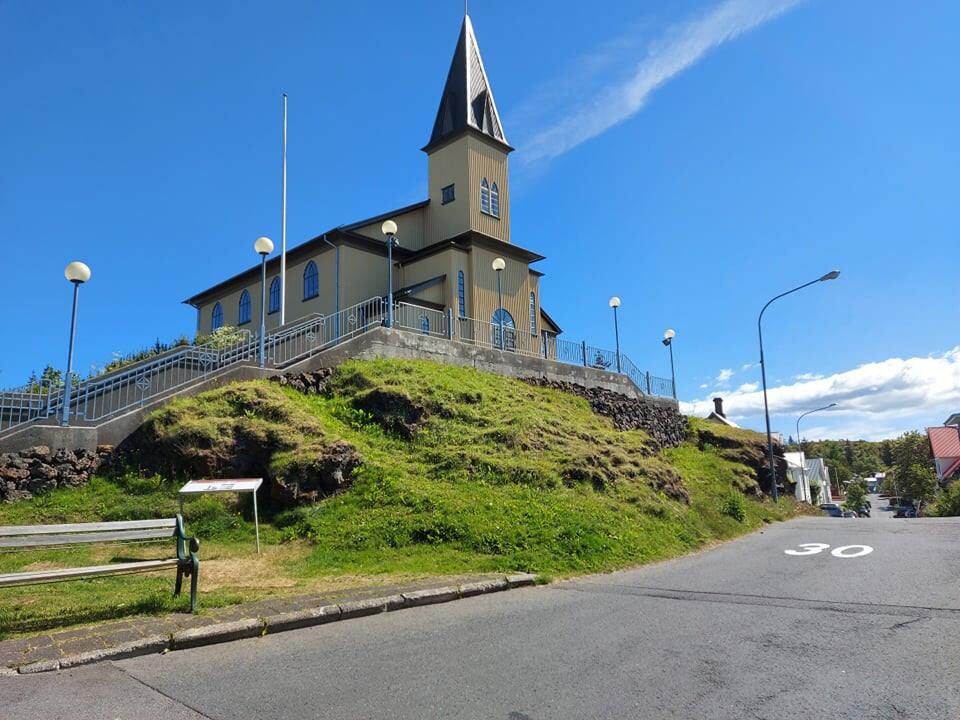
A new historical plaque, summarising the history of East Street in Hafnarfjörður, was unveiled at a small but pleasant ceremony on our Icelandic national day, 17th June. At the same time, a new and interesting historical walking tour of East Street was launched. The Austurgata Festival would have celebrated its 10th anniversary on 17th June, but due to social distancing restrictions, the festival was postponed until 2021. The information board, which stands below the Fríkirkjan, was produced by the Hafnarfjörður Folk Museum and features historical images and
Text about the street in Icelandic and English. The virtual historical walking tour is a collaboration between Wapp and the Hafnarfjörður Museum of Local History.

Austurgatan was laid between 1914 and 1918 in the so-called East Quarter.
On a history walk along Austurgata, you can experience „old Hafnarfjörður“ in a fun way and learn about the town's history and culture at the same time. This tour is illustrated with pictures from the old days. The health capital of Hafnarfjörður and Wapp – Walking app have partnered to publish walking routes in Hafnarfjörður in the Wapp guide app. When Hafnarfjörður was granted borough status in 1908, there was no planning of the settlement and few proper streets in the town. Three years later, a committee was established with the task of naming the streets and paths in Hafnarfjörður and numbering the houses in the town. The committee members named most of the existing streets and lanes in the town, but in the areas where the lack of planning was most pronounced, this rule was set aside and the areas were simply called districts, with houses numbered within them. The area where Austurgata is today was known as the so-called East Quarter at the time. Austurgata was laid out between 1914 and 1918, but today there are 15 houses on the street that are older than the road itself. The houses on East Street form an exceptionally cohesive streetscape of early 20th-century architecture, and although the street was largely built up during this period, the design and style of the houses are very varied.
Routes in Hafnarfjörður, provided by the City of Hafnarfjörður
Several walking routes in Hafnarfjörður are on the app, all provided by the City of Hafnarfjörður. Click „Map“ once the route has been opened, and „Yes“ to the question „Do you want to buy this tour?“. The route will then appear free of charge.
- Austurgata, history walk
- Mindfulness Walk at Hvaleyrarvatn
- Hvaleyrarvatn and Stórhöfði
- Joke Walk in the city centre
- A history walk around Hafnarfjörður
The routes include maps, GPS coordinates, photographs and information in Icelandic and English.
It is hoped that this collaboration will make it easier for residents of Hafnarfjörður and others to access information about interesting walking routes, historical insights into cultural heritage, and outdoor recreation opportunities in Hafnarfjörður, and encourage increased physical activity and time spent outdoors.
About the app
The app is a digital database of route descriptions in Iceland, delivered via an app for iPhone and Android smartphones. The route descriptions cover the entire country, featuring GPS tracks and photographs, and are delivered to users in English and Icelandic. The route descriptions are downloaded to the phone and used without a data connection. Stokkur ehf. develops the app and Samsýn ehf. provides the map base for Iceland.